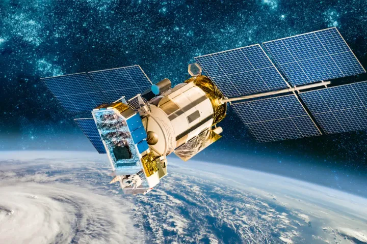
A Clear and Practical Guide to Understanding Satellites and Their Role in Everyday Life
Satellites are a foundational part of modern life, even though they operate far beyond everyday visibility. From navigation apps and weather forecasts to television broadcasts, internet connectivity, disaster monitoring, and scientific research, satellites quietly support countless services people rely on daily. A satellite is an object placed into orbit around Earth or another celestial body to collect data, relay signals, or perform scientific observations. While the concept may sound complex, satellites are designed to solve practical problems: observing Earth, enabling communication, guiding transportation, and expanding human understanding of space. As technology advances, satellites are becoming smaller, more affordable, and more numerous. This guide explains satellites in a simple, user-focused way, covering their benefits, limitations, types, innovations, key features, leading organizations, selection considerations, operational tips, common questions, and practical takeaways.
Benefits of Satellites
1. Global Communication
Satellites enable communication across long distances where cables or towers are impractical. Television broadcasting, satellite phones, and internet services depend on them.
2. Navigation and Positioning
Global navigation satellite systems support location-based services used in smartphones, vehicles, aviation, and maritime navigation.
3. Weather Monitoring and Forecasting
Meteorological satellites track clouds, storms, temperatures, and atmospheric changes, improving weather predictions and early warnings.
4. Earth Observation and Environmental Monitoring
Satellites observe land use, oceans, ice caps, forests, and pollution, helping scientists and governments monitor environmental change.
5. Disaster Management and Emergency Response
During floods, earthquakes, fires, or hurricanes, satellites provide critical data when ground infrastructure is damaged or inaccessible.
6. Scientific Research and Exploration
Satellites support astronomy, climate research, space science, and exploration of other planets and celestial bodies.
7. National Security and Defense
Many countries use satellites for surveillance, reconnaissance, and secure communication.
Limitations of Satellites
1. High Development and Launch Costs
Designing, building, and launching satellites requires significant investment, although costs are decreasing with new technologies.
2. Limited Operational Lifespan
Satellites eventually run out of fuel or experience component failure, limiting their usable lifespan.
3. Space Debris Risks
Defunct satellites and fragments pose collision risks to operational spacecraft.
4. Signal Latency
Satellites in higher orbits may introduce delays, especially noticeable in communication services.
5. Weather and Atmospheric Interference
Certain signals can be affected by heavy rain, solar activity, or atmospheric conditions.
6. Regulatory and Orbital Constraints
Satellite deployment must comply with international regulations and orbital slot availability.
Types of Satellites
1. Communication Satellites
These satellites relay signals for television, radio, telephone, and internet services.
Common uses:
• Broadcasting
• Broadband connectivity
• Satellite phones
2. Navigation Satellites
Provide positioning, navigation, and timing data used worldwide.
Common uses:
• GPS navigation
• Aviation and maritime guidance
• Mapping and surveying
3. Earth Observation Satellites
Capture images and data about Earth’s surface and atmosphere.
Common uses:
• Environmental monitoring
• Agriculture planning
• Urban development
4. Weather Satellites
Specialized satellites that monitor weather systems and climate patterns.
5. Scientific and Research Satellites
Used for space science, astronomy, and experimentation beyond Earth.
6. Military and Defense Satellites
Support secure communication, surveillance, and strategic operations.
7. Technology Demonstration Satellites
Test new components, sensors, or systems before large-scale deployment.
Satellite Orbit Categories
1. Low Earth Orbit (LEO)
Located up to about 2,000 km above Earth.
Advantages:
• Lower latency
• Lower launch cost
Uses:
• Earth observation
• Internet constellations
2. Medium Earth Orbit (MEO)
Located between LEO and geostationary orbit.
Uses:
• Navigation systems
3. Geostationary Orbit (GEO)
Located about 35,786 km above Earth.
Advantages:
• Fixed position relative to Earth
Uses:
• TV broadcasting
• Weather monitoring
Comparison Table: Satellite Types and Orbits
| Satellite Type | Orbit | Primary Function | Typical Coverage |
|---|---|---|---|
| Communication | GEO / LEO | Data and signal relay | Regional to global |
| Navigation | MEO | Positioning and timing | Global |
| Earth Observation | LEO | Imaging and sensing | Local to global |
| Weather | GEO / LEO | Climate and weather tracking | Regional to global |
| Scientific | LEO / Deep Space | Research and exploration | Mission-specific |
Latest Trends and Innovations in Satellites
1. Small Satellites and CubeSats
Miniaturized satellites reduce cost and development time, making space access more affordable.
2. Satellite Constellations
Large groups of satellites work together to provide continuous global coverage, especially for internet services.
3. Reusable Launch Vehicles
Reusable rockets significantly lower launch costs and increase launch frequency.
4. Electric Propulsion
Efficient propulsion systems extend satellite lifespan and reduce fuel requirements.
5. AI and Onboard Data Processing
Artificial intelligence enables satellites to process data in space, reducing transmission demands.
6. Software-Defined Satellites
Satellites can update functions through software, increasing flexibility and adaptability.
7. Improved Space Sustainability Practices
Efforts include deorbiting plans, debris tracking, and end-of-life disposal strategies.
Key Features to Consider When Evaluating Satellites
1. Mission Objective
Define whether the satellite is intended for communication, observation, navigation, or research.
2. Orbit Selection
Orbit determines coverage area, signal latency, and mission suitability.
3. Payload Capabilities
Sensors, cameras, antennas, or instruments define what the satellite can do.
4. Power System
Solar panels and batteries must support mission duration and payload demands.
5. Communication Systems
Data transmission speed, frequency bands, and ground station compatibility matter.
6. Lifespan and Reliability
Component quality and redundancy affect operational longevity.
7. Launch Compatibility
Satellite size and mass must match available launch options.
8. Regulatory Compliance
Licensing, frequency allocation, and orbital coordination are essential.
Major Satellite Companies and Public Information Sources
The following organizations are widely known for satellite development, launch services, or satellite-based solutions. These links are informational references, not endorsements.
| Organization | Known For | Public Link |
|---|---|---|
| NASA | Space research and Earth observation | https://www.nasa.gov |
| ESA (European Space Agency) | Earth and space missions | https://www.esa.int |
| SpaceX | Launch services and satellite constellations | https://www.spacex.com |
| OneWeb | Low Earth orbit communication satellites | https://www.oneweb.world |
| Planet Labs | Earth observation satellites | https://www.planet.com |
| Maxar Technologies | High-resolution Earth imagery | https://www.maxar.com |
| Lockheed Martin | Satellite manufacturing | https://www.lockheedmartin.com |
| Airbus Defence and Space | Satellite systems and services | https://www.airbus.com |
How to Choose the Right Satellite Solution
Step 1: Define the Use Case
Determine whether the need is communication, navigation, observation, or research.
Step 2: Identify Coverage Requirements
Global coverage, regional focus, or targeted observation affects satellite design.
Step 3: Select Orbit Type
Choose LEO, MEO, or GEO based on latency, coverage, and mission goals.
Step 4: Evaluate Data Needs
Consider resolution, frequency of data collection, and transmission speed.
Step 5: Assess Budget and Timeline
Small satellites may offer faster deployment at lower cost.
Step 6: Review Regulatory Requirements
Ensure compliance with international and national space regulations.
Step 7: Consider Ground Infrastructure
Ground stations and data processing capabilities are essential.
Selection Checklist for Satellite Projects
[ ] Mission objectives defined
[ ] Orbit type selected
[ ] Coverage area identified
[ ] Payload requirements confirmed
[ ] Power and lifespan needs assessed
[ ] Communication system evaluated
[ ] Launch options reviewed
[ ] Regulatory approvals considered
[ ] Ground station availability confirmed
[ ] Budget and schedule aligned
[ ] End-of-life disposal planned
Tips for Best Use and Long-Term Management of Satellites
1. Monitor Satellite Health Continuously
Track power levels, temperatures, and system performance.
2. Update Software When Possible
Software updates can extend functionality and fix issues.
3. Plan Fuel Usage Carefully
Efficient fuel management extends operational life.
4. Coordinate with Space Traffic Management
Avoid collisions by sharing orbital data and tracking debris.
5. Maintain Ground System Reliability
Ground stations must be secure, well-maintained, and updated.
6. Prepare for End-of-Life Procedures
Responsible deorbiting or disposal reduces space debris risks.
7. Document Performance Data
Operational records support future mission planning and improvement.
FAQs About Satellites
1. How many satellites orbit Earth today?
There are several thousand active satellites, with many more planned in coming years.
2. How long do satellites last?
Lifespans vary, typically ranging from 5 to 15 years depending on design and orbit.
3. Can satellites see people or objects clearly on Earth?
Resolution varies. Some satellites can see large objects clearly, but individual people are not typically identifiable.
4. Do satellites work at night?
Yes. Many satellites use radar or thermal sensors that do not rely on sunlight.
5. What happens when a satellite stops working?
It may be deorbited, moved to a graveyard orbit, or remain inactive depending on design and regulations.
6. Are satellites affected by space weather?
Yes. Solar storms and radiation can disrupt electronics and signals.
7. Can individuals or small companies use satellite data?
Yes. Many organizations provide open or commercial satellite data services.
Conclusion: A Practical Takeaway
Satellites are essential tools that support communication, navigation, environmental monitoring, scientific discovery, and global connectivity. While they involve complex technology and operational challenges, ongoing innovation has made satellite systems more accessible and versatile than ever before.
By understanding satellite types, orbits, benefits, limitations, and selection factors outlined in this guide, readers can better appreciate how satellites shape modern life. Whether for education, research, business, or public services, satellites continue to play a critical role in connecting and understanding our world.